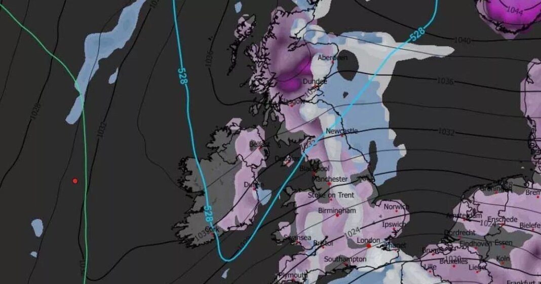
The UK may experience additional snowfall later in the month as a potential ‘Beast from the East’ weather phenomenon looms on the horizon.
According to advanced forecast maps, a significant weather front is projected to sweep over the UK from the East on January 23, ushering in snowfall across the country. Cities such as London, Birmingham, Manchester, Newcastle, and Glasgow could witness snow showers around midday.
The GFS weather model indicates that snowfall is expected to persist on January 23 and 24, impacting areas like Wales and Northern Ireland as well. Snow coverage maps for January 24 and 25 demonstrate the widespread nature of this wintry weather event.
These maps illustrate snow accumulation from southern England to northern Scotland, covering a distance of approximately 600 miles. Various cities including London, Bristol, Cardiff, Birmingham, Nottingham, Norwich, Manchester, Newcastle, Edinburgh, Glasgow, Dundee, and Aberdeen are all depicted with snow cover.
This upcoming blizzard may evoke memories of the notorious Beast From The East in 2018, which brought freezing temperatures as low as -14C and snow depths exceeding 20 inches in some regions.
While the approaching weather system is anticipated to originate from the East, snow accumulation levels are expected to be less severe. Data suggests that Scotland may see up to eight inches of snow, northern England up to two inches, and other regions about one inch of snow accumulation.
Long-range forecasts from BBC Weather also hint at the likelihood of more snow later in the month and at the beginning of February. The forecast for January 19 to 25 indicates a low probability of significant snowfall, but chances of wintry showers, especially in northern areas like Scotland, during colder and brighter intervals between weather systems. Most regions can expect near or above normal precipitation levels with further melting of any remaining snow.
The forecast for January 26 to February 8 suggests a continuation of mild west to south-westerly winds with periodic wet and windy conditions from Atlantic low pressure systems. Brief colder periods, mainly in northern UK regions, are projected to be temporary, with temperatures likely to average above normal levels.
However, there is some uncertainty regarding the possibility of high pressure building over Scandinavia in the coming weeks, potentially leading to colder air flows. This scenario is currently not the favored outcome but remains a factor to monitor.
At Reach and across our entities , we and our partners utilize data collected via cookies and other identifiers from your device to enhance user experience on our platform, analyze usage patterns, and provide personalized advertising. You retain the option to opt out of data sharing or selling at any time by selecting the “Do Not Sell or Share my Data” button located at the bottom of the website. Please be aware that your preferences are specific to the browser in use. Your use of our website and services implies consent to the use of cookies and agreement with the practices outlined in our <a href="https://www.mirror.co.uk/privacy

